
Intelligent Solution: MAPS ▼
STEP 1: Problem As Described by Client
“I need three maps for a soon-to-be-published book. I have copies of outline maps drawn by a friend, but I may need to make a few changes. My publisher may have certain requirements. I know they have to be published in black and white.”
▲ STEP 2: Analysis by MetaGlyfix
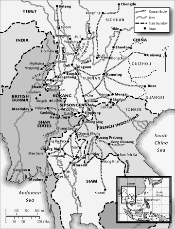
The author’s outline maps show the land areas and boundaries, the rivers and other bodies of water, the towns, roads, and special features that the author wants to illustrate, with their labels.
The author’s copies vary in size but all are larger than a page of the book in which they will be published. As is, they would be reduced for printing, which would make critical text and other elements illegibly small. Most significantly, the author has only photocopies, a medium whose quality degrades with every reproduction and is absolutely unacceptable for imagesetter printing.
In one map a featured area is shaded, but the photocopy renders it a dark mass that blots out labels and other features. Otherwise in the maps, no one area is distinguished from another in color, pattern, or shading.
The maps lack basic guideposts: no scale, no key, no compass indicator, no cartouche, no inset to show where the map area fits in a larger world area.
MetaGlyfix concludes that while it is possible merely to scan each existing map and painstakingly touch up the scans, making such adjustments would be far more time-consuming and expensive than drawing each map anew. And the visual quality would remain subpar.
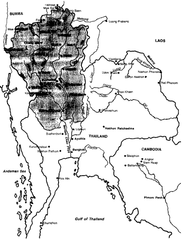
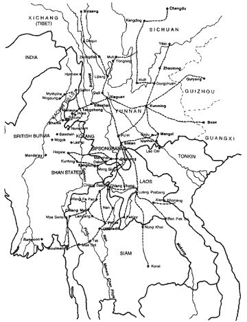
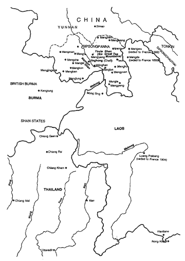
Author’s sketches
(Click/tap map to view finished illustration)
▲ STEP 3: Solution by MetaGlyfix
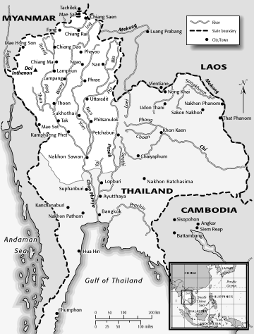
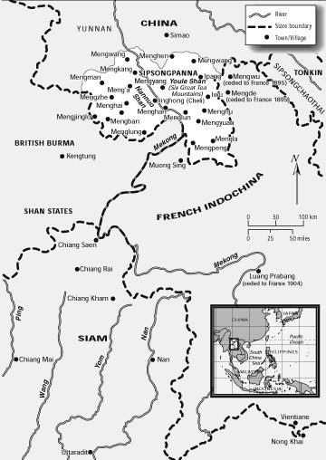
MetaGlyfix draws the maps anew at full size (larger than publication size). Calculations are made to ensure that when the illustration is reduced in scare, all text will be legible and even thin lines will be visible.
Data necessary to fit the guideposts — a scale (in km and miles), a key, a world area inset, and a compass — are researched and calculated. Using this information, each of these components are drawn as separate technical illustrations, scaled, and inserted in each map.
The MetaGlyfix designer creates a uniform “look” for the set of three maps that will display clearly what the author wants to illustrate while meeting essential design criteria:
- aesthetically coherent across the three maps
- compatible with the style, tone, and content of the book
- technically efficient to meet publisher’s and printer’s requirements
Key elements of the design are:
- subtle shades of very light gray for land areas, and the lightest gray possible for oceans and seas
- featured areas are offset in pure white (contrasting with the surrounding grays)
- coastlines delineated by a smooth, tri-shaded gray shadow
- legible, meaningful use of dashed, dotted, and varying-width lines to mark boundaries and routes that the author wants to feature
▲ STEP 4: Proofs and Revisions
MetaGlyfix creates PDF proofs for the author and publisher. The author decides to change some of his original map data. MetaGlyfix revises the maps to incorporate author changes. More proofs are made and reviewed, repeatedly, until the client is satisfied with all visible elements.
▲ STEP 5: Publishable Files
Once the author has approved a final version of each map, MetaGlyfix then makes the technical adjustments required for printing. Following the specifications of the publisher and printer, a new, clean vector file for each map is produced. Extraneous and interim elements are eliminated. Each map is scaled to fit the book's dimensions and the publisher’s style (margins, etc.). Any related files are prepped for printing, and all are transmitted to the printer for high-resolution output on an imagesetter.
Finished MetaGlyfix Illustrations
(Click/tap map to see author sketch from which it evolved)
Last updated 31 January 2026 (Saturday) at 12:08:59 PST ▲